Tag: Buyer Guide

  • What’s It Like to Live Near the Chestatee River?

    What’s It Like to Live Near the Chestatee River?

    Quick answer (TL;DR)

    Living near the Chestatee River means choosing a genuinely rural lifestyle within reach of Dahlonega, typically 15 to 30 minutes from town depending on which part of the corridor you’re in. You’ll find wooded lots, river-access properties, and a mix of cabins and custom homes. Before committing, ask about flood zone designations, well and septic systems, and whether the property has deeded river access or sits directly on the bank.

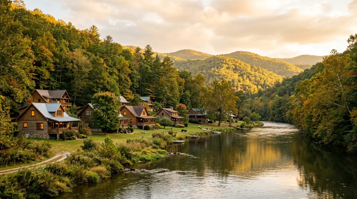
    The Chestatee River runs through Lumpkin County on its way south toward Lake Lanier, threading through wooded hills and quiet communities most buyers don’t find until they’re actively searching. The corridor’s rural character draws buyers who want genuine quiet and outdoor access without being far from Dahlonega’s services.

    What the Chestatee River corridor actually looks like

    The Chestatee River originates in the Blue Ridge Mountains and flows southwest through Lumpkin County before reaching Hall County and eventually Lake Lanier. Along that corridor, the terrain is rolling Southern Appalachian foothills, lower in elevation than the high peaks further north but heavily wooded and noticeably quieter than Gainesville or the Atlanta exurbs.

    Most properties near the river sit on larger lots than buyers are used to in suburban markets. One-acre parcels are common; multi-acre tracts along or near the water aren’t unusual. The mix of hardwood and pine forest creates a seasonal character that shifts through the year: bare canopy in winter, dense green through summer, and a solid fall color display that draws a lot of interest from September through November.

    If you’re comparing this corridor to other parts of North Georgia, it differs from the high-elevation terrain around Blairsville and the resort-development concentration in Blue Ridge. It’s a quieter, more working-rural stretch of land, with small communities and Dahlonega functioning as the area’s main hub for groceries, dining, banking, and services.

    For a broader overview of property types and price ranges across the corridor, the Chestatee real estate page covers the full market picture.

    The kinds of homes you find near the river

    Riverfront versus river-access properties

    The distinction matters more than most buyers realize before they start touring. Riverfront properties sit directly on the water. The boundary includes the bank, and the owner has immediate access from the yard. River-access properties are set back from the river but carry deeded rights to reach it, sometimes through a shared parcel or recorded easement. Both differ from simply owning land near the river with no formal access rights.

    Riverfront land commands a premium in this corridor. For what’s currently available on and near the water, the Chestatee River waterfront homes page is updated regularly with active listings.

    Log homes and cabin-style construction

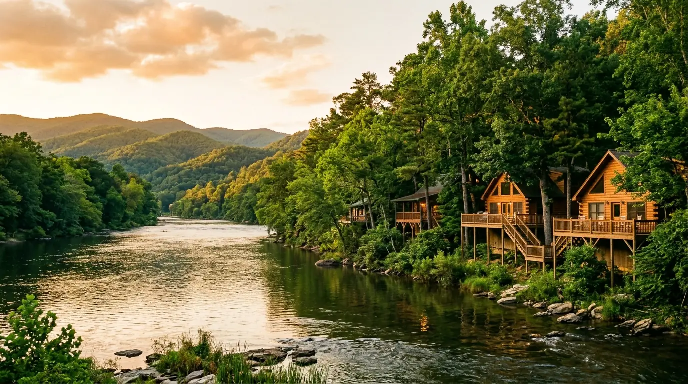
    Log homes and cabin-style builds show up frequently in the Chestatee corridor. They fit the landscape well and appeal to buyers who want the mountain aesthetic. One thing to factor in before making an offer: log home maintenance is real and ongoing. Refinishing, sealing, and restaining are typically needed every three to five years, and that work generally runs $3,000 to $8,000 depending on the home’s size and the products used. A well-maintained log home holds up fine, but deferred maintenance becomes visible fast. Factor it into your purchase price negotiation.

    Custom builds and full-time residential homes

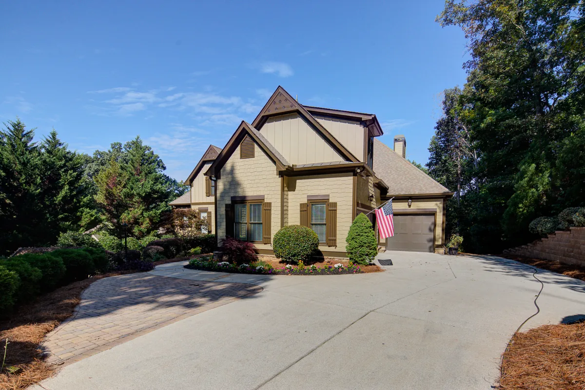
    There’s also a tier of custom-built homes and significantly updated older properties, especially in areas where lots were planned for full residential use rather than seasonal or recreational ownership. These properties tend to have more square footage, more modern systems, and sometimes more recent construction than the cabin tier. They appeal to buyers relocating full-time rather than buying a second home.

    What day-to-day life looks like

    Distance from Dahlonega

    Most of the Chestatee River corridor is within 15 to 30 minutes of Dahlonega, depending on where along the river you’re located. Dahlonega has what you need day to day: grocery stores, gas stations, hardware, local restaurants, a hospital, and professional services. It’s not a large city, but it’s far from a rural outpost. The historic square is walkable and functional, not just a tourist attraction.

    For anything beyond Dahlonega, Gainesville is roughly 30 to 45 minutes southeast. That puts Gainesville’s larger hospital network, specialist medical care, and big-box retail within reach. Atlanta’s northern suburbs extend the range further. That’s realistic for occasional trips but not for daily commuting from most river corridor addresses.

    Remote work and internet connectivity

    Internet service quality varies significantly across the corridor. Some areas have reliable broadband; others, especially in wooded or more rural sections, are limited to satellite internet or fixed wireless. The newer generation of satellite internet has made remote work viable from places where it wasn’t a few years ago, but verify the actual available service at the specific address, not the ZIP code coverage estimate. Do this before you schedule a showing, let alone make an offer.

    The seasonal rhythm

    River corridor living has a seasonal character that city residents tend to underestimate. Fall changes the property, and the whole corridor, noticeably. Winter is genuinely quiet; some roads and driveways can be tricky after ice, and a four-wheel-drive vehicle matters for some of the less-maintained private roads. Spring brings wildflowers, and the green returns fast. Summer is full canopy and humid, but the river corridor stays measurably cooler than Atlanta.

    What to think through before you make an offer

    Flood zone status

    A portion of properties near the Chestatee River fall within FEMA-designated flood zones. That designation affects both required insurance and what you can build or modify on the property. The FEMA Flood Map Service Center (msc.fema.gov) is the authoritative lookup. Use the specific property address, not the general area. Your lender will require this information anyway; resolving it early saves time later.

    Well and septic systems

    Rural Lumpkin County properties overwhelmingly operate on private wells and septic systems. Both require pre-purchase inspection from qualified specialists. The general home inspector isn’t the right person for this. For the well, key questions are flow rate, water quality test results, and age of the pump and pressure system. For septic, the concern is capacity relative to the home’s bedroom count, the condition of the tank and drain field, and maintenance history. Budget for these inspections and factor in the possibility of repair or replacement, especially on older properties.

    Road access and private infrastructure

    Some riverside properties are reached via gravel roads or private drives that county maintenance doesn’t cover. Before closing, clarify who is responsible for maintaining the road, whether any shared-road agreements exist with neighboring parcels, and how the access holds up after rain or winter ice. This matters on secluded lots where the access road is longer or more rugged.

    For a structured walkthrough of the buying process specific to this corridor, the guide to buying a home near the Chestatee River covers the steps and local diligence considerations in detail.

    Communities along the Chestatee River

    The Chestatee River corridor isn’t a single development. It spans several community types across Lumpkin County, from gated neighborhoods with amenities to unincorporated rural tracts with no association at all.

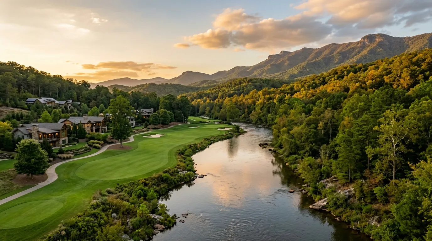
    Achasta is the best-known gated community on the river. It sits in Dahlonega with a Jack Nicklaus Signature 18-hole golf course and direct access to the Chestatee River, drawing buyers who want private amenity access alongside a natural setting. HOA governance applies, and the community’s covenants affect how you can use the property. Verify the full covenant package before making an offer.

    Outside gated communities, much of the corridor consists of larger rural lots with minimal formal structure. Some neighborhoods have loose property owners’ associations; many don’t. What’s available shifts depending on which section of the river you’re searching.

    For a community-by-community breakdown, the communities along the Chestatee page maps out the distinct areas and what buyers typically find in each.

    Frequently Asked Questions

    What’s the difference between a riverfront property and a river-access property?

    A riverfront property has a boundary that includes the riverbank: walk out your back door and you’re at the water. A river-access property is set back from the river but has deeded rights to reach it, usually through a shared parcel or recorded easement. Both differ from simply owning land near the river with no formal access rights. Ask to see the recorded easement language before assuming what “river access” means on any listing.

    Are Chestatee River homes in a flood zone?

    Some are, some aren’t. Proximity to the river increases the likelihood of a flood zone designation, but it isn’t universal. Look up the specific address at the FEMA Flood Map Service Center (msc.fema.gov) and confirm with your insurance agent what zone the property falls in. Properties in special flood hazard areas require flood insurance if you have a federally backed mortgage, and that cost should factor into your offer.

    How far is the Chestatee River corridor from Dahlonega?

    Most properties are within 15 to 30 minutes of Dahlonega’s town square, depending on which part of the corridor you’re in. Some outlying areas can push that to 35 minutes or more. Map the actual drive time for any property you’re seriously considering. Check it at the times you’d realistically be traveling, not just once on a slow Sunday morning.

    What types of homes are available near the Chestatee River?

    The range runs from small cabin-style homes on modest lots to larger custom riverfront builds on multi-acre tracts. Log homes are common and fit the landscape. They come with maintenance requirements buyers should budget for. There are also more conventional stick-built and ranch-style homes in the corridor, mainly in areas developed for full-time residential use.

    Are there HOAs in Chestatee River communities?

    It depends on the community. Achasta has formal HOA governance and covenants. Some other communities have loose property owners’ associations. Many rural riverside lots are unincorporated with no HOA. Confirm HOA status and request the full covenant documents before making an offer. Covenant restrictions can significantly affect what you can do with the land.

    What should I know about well and septic before buying near the river?

    Get both inspected by specialists before closing. For the well, flow rate and water quality results matter as much as equipment age. For septic, capacity, condition, and maintenance history are the key factors. Plan inspections early. Results can affect your negotiation, and scheduling these takes time.

    Is the Chestatee River corridor good for retirees?

    Retirees make up a significant share of buyers in this corridor. Property costs are generally lower than in Atlanta suburbs, Dahlonega is a real small town within easy reach, and the mountain climate is relatively mild. Medical access is the main practical consideration. Confirm that the specialist care you may need is accessible from the specific area before committing.

    What are property taxes like in Lumpkin County?

    Lumpkin County’s property tax rates are generally lower than most metro Atlanta counties, but the specific millage rate, assessed value methodology, and available homestead exemptions change over time. Verify the current numbers with the Lumpkin County Tax Assessor’s office. Don’t rely on an estimate from a listing or an online tool that may reflect an outdated assessment.

    Is internet service reliable near the Chestatee River?

    Coverage varies by location. Some areas in the corridor have fiber or cable broadband; others rely on fixed wireless or satellite. Newer satellite internet services have improved significantly, but performance still varies by location and tree canopy. Check what’s available at the specific address, not just the county or ZIP code, before assuming connectivity will meet your needs.

    How much does log home maintenance cost near the river?

    Plan on refinishing, sealing, and restaining every three to five years. That cycle typically runs $3,000 to $8,000 depending on the home’s size and the products used. River proximity means more moisture exposure, which can accelerate wear on the exterior finish. A log home maintained on schedule is a very different purchase than one that hasn’t been touched in a decade. Inspect carefully and ask for maintenance records.

    Can I build a dock or structure on the Chestatee River bank?

    Georgia riverbank construction is subject to state environmental regulations, potential Army Corps of Engineers jurisdiction depending on the reach of the river, and your property’s flood zone designation. What a neighboring property has isn’t a reliable guide. Regulations and permits are property-specific. Consult a local real estate attorney and contact Georgia EPD before making construction plans part of your buying rationale.

    How do I start my search for a home near the Chestatee River?

    Start by getting clear on the basics: riverfront or river-access, full-time or second home, internet requirements, and your comfort with well and septic systems. Look at several property types across the corridor before locking in on one. A local agent who knows the river properties will shorten the learning curve on the diligence questions specific to this area.

    Ready to explore what’s available along the Chestatee River corridor? Find your next Dahlonega, Lumpkin County home with Gold Peach Realty, North Georgia’s local experts in river-corridor and Lumpkin County real estate. Call (770) 283-1223 to connect with an agent who knows this market.
  • What Should You Know Before Buying Riverfront Property in Georgia?

    What Should You Know Before Buying Riverfront Property in Georgia?

    Quick answer (TL;DR)

    Riverfront property in Georgia comes with layers of ownership you don’t see in a standard home sale. You need to verify whether your deed grants actual water access or just proximity to the river, check the FEMA flood map and get an elevation certificate, and inspect the well and septic system with an eye on riparian setback rules. All of that due diligence should happen before you waive contingencies.

    Buying a home on or near the Chestatee River means reading the deed, the flood map, and the septic report before you fall in love with the view. This guide walks through each step.

    The Chestatee River corridor in Lumpkin County draws buyers looking for something the subdivisions can’t offer: a yard that ends at moving water. But riverfront and river-access properties carry diligence requirements that go well beyond a standard inspection. This guide covers what to verify, in what order, so nothing surfaces after closing.

    What the deed says about your rights to the river

    Riverfront, river-access, and near the river

    These three phrases describe very different ownership situations, and listings use them interchangeably. Before you schedule a showing, ask the listing agent which one applies and pull the deed to confirm it.

    Listing languageWhat it typically meansWhat to verify
    RiverfrontProperty line touches the bankWhere the line falls on the survey; confirm it’s not a setback easement
    River accessDeeded right to reach a specific access pointAccess easement is recorded; confirm who maintains it
    Near the river / river viewsProximity only, no water rights grantedDistance to bank and any buffer restrictions on intervening land

    Georgia follows riparian doctrine, which ties water-use rights to land ownership along the bank. If your property line reaches the river, you have riparian rights. If it doesn’t, you don’t, regardless of how close the water looks on a satellite map.

    Who owns the riverbed in Georgia?

    On navigable rivers, Georgia law vests ownership of the riverbed in the state. The Chestatee is classified as navigable in parts, which means the state, not you, owns the bed beneath the water. Your riparian rights let you use the water adjacent to your land for reasonable purposes, but you can’t block public passage on the river itself. For non-navigable stretches, the adjacent landowner typically owns to the center of the riverbed. Your attorney should confirm the navigability classification for the specific parcel you’re buying.

    Flood zones and the FEMA maps to check

    Georgia riverfront property can sit in a range of flood zones, and the zone determines both your insurance cost and your ability to build or expand. Check the flood zone status for Chestatee River homes before you make an offer.

    How to look up the flood zone for any property

    Go to FEMA’s Flood Map Service Center at msc.fema.gov. Enter the address and pull the Flood Insurance Rate Map (FIRM). The zones you’ll see most often on Chestatee River corridor properties:

    Zone X covers areas outside the 500-year floodplain. Flood insurance isn’t federally required here, though lenders sometimes ask for it anyway.

    Zone AE is the high-risk designation, inside the 100-year floodplain with base flood elevations established. If the property carries a federally backed mortgage, flood insurance is mandatory. Annual premiums through the National Flood Insurance Program typically run between $800 and $2,500 for a single-family home, depending on elevation and coverage amount. That range is based on national NFIP data; get a quote specific to the property from your insurance agent.

    Zone AO covers areas with shallow sheet-flow flooding, often found where the river spreads across a floodplain rather than staying in a defined channel.

    Elevation certificates and why they matter

    An elevation certificate (EC) documents where the lowest floor of the structure sits relative to the base flood elevation. Even in Zone AE, a home built above the base flood elevation can qualify for substantially lower insurance premiums. Always ask whether an existing EC is on file. If not, budget roughly $500 to $1,000 for a licensed surveyor to produce one. It’s often money well spent before you lock in a rate.

    Well and septic on river corridor properties

    Most riverfront properties in Lumpkin County are on private well and septic rather than public utilities. That’s not a problem by itself, but it does mean you’re taking on infrastructure that requires its own inspection and ongoing maintenance budget.

    Well inspection: what to verify

    A licensed well contractor should test flow rate, water quality, and equipment condition. Adequate flow for a residential property is generally considered 3 to 5 gallons per minute, though some lenders set a minimum of 5 GPM. Have the water tested for bacterial contamination and nitrates at a state-certified lab. Near agricultural land or older properties, also test for pesticides and heavy metals. Ask the seller for any prior test results and the date the well was drilled.

    Septic near a riverbank

    Georgia’s Environmental Protection Division and local county health departments set minimum setback distances between septic systems and surface water. In most Georgia counties, the drain field must sit at least 50 feet from a perennial stream; some counties require 100 feet. If the existing system was installed before current regulations, it may be grandfathered, but a sale can trigger re-evaluation by the county. Have a licensed septic inspector confirm the system’s location, capacity, and condition. Replacing a drain field on a sloped river lot can cost between $5,000 and $15,000 or more depending on site conditions, so don’t skip this step.

    What you can and can’t build near the riverbank

    Georgia’s stream buffer requirements

    Under the Georgia Erosion and Sedimentation Act, there is a 25-foot state-mandated buffer along all streams, and many local governments impose a stricter 50-foot or 100-foot buffer. Within those buffers, you generally can’t disturb vegetation, grade soil, or place structures. If the property has a dock, a deck extending toward the water, or a cleared path to the riverbank, ask whether permits were pulled for those improvements. Unpermitted work can become your problem at closing if it triggers a compliance order.

    Army Corps of Engineers permits

    Any work that places fill material in or near navigable waters or wetlands requires a Section 404 permit from the Army Corps of Engineers. This covers docks, rip-rap bank stabilization, and some clearing work near the water’s edge. If the seller made any improvements to the bank or waterline, get documentation showing the Corps approved them. Without it, you could inherit a compliance violation that’s yours to resolve after closing.

    Road access on rural riverfront parcels

    Riverfront parcels in rural Lumpkin County sometimes reach the main road via a private gravel drive shared with neighbors. That’s workable if there’s a recorded maintenance agreement spelling out cost-sharing and upkeep obligations. It’s a problem if the access is informal, built on years of good-neighbor practice that nobody documented. Ask for a recorded easement and a copy of any existing maintenance agreement. If neither exists, price in what it would cost to formalize one, or to negotiate your own driveway access from the public road.

    HOA governance and community type

    Some of the most desirable riverfront properties in the Chestatee corridor sit inside planned communities with their own governing documents. Achasta, for example, is a gated golf community in Dahlonega built around a Jack Nicklaus Signature 18-hole golf course and the Chestatee River. If you’re considering a home there, the purchase includes membership in the homeowners association, and the HOA covenants govern what you can do with your property.

    Covenant documents govern what you can and can’t do with your property inside the community. Read the full CC&Rs before you make an offer, not after.

    Browse Chestatee River waterfront homes to see active listings across community types, or look specifically at waterfront homes near Dahlonega if you want to stay close to town.

    Budget items beyond the purchase price

    Riverfront property often carries ongoing costs that don’t show up in a standard mortgage calculator. Build these into your underwriting before you finalize an offer. See our breakdown of what to budget for a river corridor purchase for more detail on typical annual carrying costs.

    Flood insurance, if the property is in Zone AE, typically runs between $800 and $2,500 per year depending on elevation and coverage amount. Get a quote specific to the property before you commit, not the national average.

    Well and septic maintenance runs a few hundred dollars per year for routine pumping and testing. A failed drain field or a well pump replacement can run several thousand dollars with little warning, so budget for it.

    Log homes and cabins, common in this corridor, require periodic refinishing, sealing, and restaining. Expect to spend between $3,000 and $8,000 every three to five years depending on exposure and the finish type used.

    Shared road maintenance, if your access drive is co-owned with neighbors, may cost anywhere from a few hundred to a few thousand dollars per year depending on the agreement terms and the road’s condition going in.

    Frequently Asked Questions

    What are riparian rights in Georgia?

    Riparian rights are the water-use rights that come with owning land adjacent to a river or stream. In Georgia, property owners whose land borders a waterway have the right to reasonable use of that water. The rights travel with the deed, so if the property line doesn’t reach the bank, you don’t automatically have riparian rights even if the water is visible from the house.

    How do I check the flood zone for a property on the Chestatee River?

    Go to FEMA’s Flood Map Service Center at msc.fema.gov and enter the property address. The site will show you the current Flood Insurance Rate Map and the zone designation for that parcel. Your real estate agent or title company can also pull the official FIRM panel if you want a more detailed reading.

    Is flood insurance required on all riverfront homes in Georgia?

    No. Flood insurance is federally required only when the property is in a Special Flood Hazard Area (Zone A or AE) and carries a federally backed mortgage. Properties in Zone X are outside the high-risk zone and face no federal mandate, though some lenders require coverage anyway. Even when it’s not required, riverfront property owners should weigh the coverage seriously given the proximity to water.

    What is an elevation certificate and do I need one?

    An elevation certificate documents where the lowest floor of a structure sits relative to the base flood elevation on the FEMA map. It matters because flood insurance premiums are tied to that relationship. A home above the base flood elevation pays less; one below pays more. If no existing certificate is on file, a licensed surveyor can produce one for roughly $500 to $1,000.

    Are there public water and sewer lines along the Chestatee River?

    Most riverfront parcels in Lumpkin County rely on private well and septic. Public utilities don’t extend to the rural stretches of the Chestatee corridor. Confirm during due diligence whether the property connects to a municipal system or runs on its own infrastructure, and inspect both thoroughly before closing.

    What’s the difference between riverfront and river-access property?

    Riverfront means the property line reaches the bank. River-access typically describes a deeded easement or right-of-way that allows you to reach a specific access point, but your property line may not touch the water. The deed and survey are the authoritative documents; listing language alone isn’t reliable enough to rely on.

    Do I need a permit to build a dock on the Chestatee River?

    Almost certainly yes. Work in or near navigable waters in Georgia requires permits from the Army Corps of Engineers under Section 404 of the Clean Water Act, and potentially from the Georgia EPD and the county as well. The process can take several months. If you’re buying a property with an existing dock, ask the seller for the permits. If none were pulled, consult a real estate attorney before you close.

    What should a well inspection cover on a riverfront property?

    Flow rate, water quality, and equipment condition are the main areas. On a riverfront or rural property, also ask the inspector to check for contamination from nearby surface water or agricultural runoff. Have samples sent to a state-certified lab for bacterial testing and a full chemical panel. Results should be in hand before you close, not after.

    How close can a septic system be to the Chestatee River?

    Georgia’s minimum setback for a septic drain field from a perennial stream is 50 feet under state regulations, though some counties impose a stricter standard. In Lumpkin County, check with the county health department for the local rule. A licensed septic inspector can measure the existing system and confirm whether it’s in compliance. Systems installed before current regulations may be grandfathered, but a sale can trigger re-evaluation.

    Can an HOA restrict what I do with my riverfront property?

    Yes. If the property is inside a planned community with recorded covenants, those documents govern what you can build, how you can use the property, and what activities are permitted. Read the covenants, conditions, and restrictions (CC&Rs) before you make an offer. Pay particular attention to sections covering rental use, dock and structure construction, and landscaping near the water.

    What questions should I ask about the flood history of a riverfront property?

    Ask the seller to disclose any prior flood events and any insurance claims filed. Request copies of prior elevation certificates. Check FEMA’s flood claims data for the address if available. In Georgia, sellers are required to disclose material defects, but flood-history disclosure practices vary. Pull the claims history from the National Flood Insurance Program if the property has a prior NFIP policy on record.

    Does road access affect the value of a riverfront property?

    It can, and significantly. A property with clear, legally documented road access via a recorded easement or a dedicated public road is easier to finance and insure than one where access depends on a neighbor’s goodwill or an undocumented right-of-way. If the title search reveals access issues, get legal advice before proceeding. Some buyers negotiate a price credit for the cost of formalizing access.

    Is the Chestatee River navigable?

    Portions of the Chestatee River are classified as navigable under Georgia law, which means the state owns the riverbed in those reaches and the public has a right to pass on the water. The navigability classification affects dock permitting, riparian rights, and public access questions for adjacent landowners. Confirm the classification for the specific parcel with a real estate attorney familiar with Georgia water law before you close.

    Start your Chestatee River corridor home search with Gold Peach Realty — North Georgia’s local experts in Dahlonega, Lumpkin County, and the surrounding mountain communities. Call (770) 283-1223 to connect with an agent who knows the river corridor.

  • Waterfront Property Near Dahlonega, GA: Where to Look

    Waterfront Property Near Dahlonega, GA: Where to Look

    Quick answer (TL;DR)

    Waterfront property near Dahlonega concentrates along three corridors: the Chestatee River main stem closest to town, its tributary creeks in the quieter hollows, and the Etowah-Lake Lanier fringe to the south. What you can buy, and what the water legally comes with, differs corridor by corridor. Pick the water first, then verify frontage, access, and flood zone before anything else.

    Waterfront property near Dahlonega, Georgia sits along the Chestatee River, its tributary creeks, and the Etowah-Lake Lanier fringe. Compare frontage, deeded access, and flood zones corridor by corridor.

    Ask for waterfront near Dahlonega and you will be shown three different kinds of property within a half hour of town: river frontage on the Chestatee itself, creek parcels folded into the hollows, and lake-flavored homes on the Etowah-Lanier fringe. All of it gets called waterfront. Only some of it is what you mean. The corridors also carry different diligence: what floods, what owns the bank, and what the access paperwork actually says. Here is where the water sits around Dahlonega, corridor by corridor, and what each one gives the buyer who wants it.

    Start with the water, not the listing

    Every buyer says waterfront; almost nobody means the same thing by it. Some mean a house whose yard touches the river. Some mean a legal right to walk down to it across a shared parcel. Some mean a view. Near Dahlonega all three get marketed as waterfront, and the price differences between them are real. Before you tour anything, decide which of those three you are actually shopping for, because it changes which corridors you look in and what you verify before an offer.

    The waterfront homes buyer’s guide covers the full diligence list. This guide is the step before it: where, physically, the waterfront inventory around Dahlonega actually sits.

    Corridor one: the Chestatee main stem

    The Chestatee River itself is the headline water near Dahlonega, running south out of the mountains through Lumpkin County. Parcels along the main stem range from small cabins on narrow frontage to larger acreage tracts, and this is the corridor where true river-frontage homes come up most often. It is also the corridor where flood-zone questions matter most, because the main stem carries the watershed’s water.

    Expect variety in what listings mean by frontage: some properties touch the river along a usable bank, others along a steep drop where the water is visible but not approachable. Walk the bank before you form an opinion from photographs.

    Corridor two: the tributary creeks

    The hollows around Dahlonega carry the Chestatee’s tributaries, creeks like Toto Creek, and the riverside communities guide maps how these settle into recognizable pockets. Creek frontage trades some of the big-river drama for quiet, smaller water, and often more land per dollar. The trade is water behavior: creeks flash after rain and can run thin in dry late summer, which matters if you are picturing a specific kind of evening.

    Creek parcels also reward a slow survey read. The good ones feel deeply private; the careless purchases discover that the usable part of the lot stops well short of the water.

    Corridor three: the Etowah and Lake Lanier fringe

    South and west of the Chestatee corridor, the country tilts toward the Etowah system and the upper reaches of Lake Lanier. This is a different market: lake-flavored rather than river-flavored, with the water often at a distance measured in minutes rather than feet, and with property types that include lake-view homes rather than true frontage. Buyers who want water-adjacent living without riverbank maintenance often land here.

    If a listing in this fringe promises lake access, read exactly what that access is. Access is a spectrum from a deeded spot at the end of a road to a neighborhood ramp to nothing enforceable at all, and the paperwork, not the aerial photo, tells you which.

    What waterfront legally comes with in Georgia

    Georgia riparian rights give the owner of land touching a navigable-water boundary specific but limited rights regarding the water, and the details sit at the level of the parcel, not the brochure. Two properties on the same river can have meaningfully different relationships with the water in front of them. The practical rules: assume nothing about docks, banks, or exclusion, and get the water-rights question answered in writing during diligence, not at closing.

    Flood zone is the other parcel-level fact. Around Dahlonega the FEMA maps for Lumpkin County carry real designations, and properties on the same stretch can sit in different zones. The flood zone guide for Lumpkin County waterfront explains what Zone AE versus Zone X means for a buyer, including the insurance conversation you will want to have early.

    The inspection list waterfront adds

    Waterfront near Dahlonega is often well and septic country, and both behave differently near moving water. The standard buyer diligence list grows: well yield and quality, septic location and condition relative to the bank and the flood line, driveway and bridge access in high water, and the erosion history of the bank itself. None of these are reasons not to buy; all of them are reasons to inspect before you are emotionally committed.

    Timing the inspections matters as much as running them. If you can walk the property after a heavy rain, even informally before an offer, you learn more about drainage, the bank, and the driveway in twenty minutes than any document will tell you. Sellers generally understand this; serious waterfront buyers look at the water in its bad moods, not just its good ones.

    Bring your standard agent questions too: what the seller knows about the water history, which storms the property has seen through, and whether anything about the bank, the outbuildings, or the septic has changed hands or repairs recently.

    How the corridors compare

    Chestatee main stem for classic river frontage closest to town. Tributary creeks for privacy and land, with smaller water. Etowah-Lanier fringe for lake-flavored living and view homes. Prices in all three move with frontage quality, acreage, and flood zone, and inventory in every corridor is thin enough that the right property is more often found by watching than by shopping a single weekend. The waterfront real estate guide goes deeper on what buyers should verify before an offer.

    Frequently Asked Questions

    Where can you buy waterfront property near Dahlonega, GA?

    Waterfront inventory concentrates along the Chestatee River main stem, its tributary creeks such as Toto Creek in the surrounding hollows, and the Etowah-Lake Lanier fringe south of the corridor. Each corridor trades frontage, privacy, and water character differently.

    What does waterfront actually mean in a Georgia listing?

    It can mean the parcel touches the water, that it carries deeded access across another parcel, or simply that the water is visible. Ask which of the three applies to any listing, and verify the answer against the deed rather than the marketing.

    Do you own the riverbank on Chestatee River frontage?

    Ownership at the water boundary is governed by Georgia riparian law and varies parcel by parcel, especially on navigable stretches. Get the specific boundary and rights question answered in writing during diligence.

    Is waterfront property near Dahlonega in a flood zone?

    Some is. FEMA maps for Lumpkin County assign zones like AE and X, and neighboring parcels can differ. Check the parcel’s designation before offering, since it drives insurance and lender requirements.

    Can you build a dock on Chestatee River waterfront?

    Dock and structure rights depend on the parcel’s riparian situation and the applicable rules for that stretch of water. Do not assume a dock is permitted; verify what the parcel allows before you count on one.

    What inspections does waterfront property need?

    Beyond the standard list: well yield and quality, septic condition and location relative to the bank and flood line, bank erosion history, and driveway or bridge access during high water.

    Is creek frontage cheaper than river frontage near Dahlonega?

    Tributary-creek parcels often offer more land for the money than main-stem Chestatee frontage, with smaller and quieter water. Which is better depends on whether you want the river’s presence or the creek’s privacy.

    What is deeded river access?

    Deeded access is a legal right, recorded with the deed, to reach the water across a defined path or parcel. It is stronger than a verbal arrangement or a customary path, and its exact terms are worth reading before you rely on it.

    How thin is waterfront inventory near Dahlonega?

    Thin in every corridor. River frontage especially comes up in small numbers, so serious buyers watch the market over weeks rather than expecting to tour a deep list in one weekend.

    Should you use a buyer’s agent for waterfront purchases?

    Yes, and ideally one who knows the specific corridors. Waterfront diligence, flood zones, wells, septic, and riparian questions are local knowledge, and the seller’s representation does not work for you.

    Does waterfront property require flood insurance?

    It depends on the parcel’s FEMA zone and your lender. Zones like AE typically trigger the insurance conversation, while Zone X often does not. Confirm the parcel’s zone and your lender’s requirement early.

    When you know which water you want, the next step is a corridor-specific search. See current Dahlonega listings at Gold Peach Realty or call (770) 283-1223.

  • Chestatee River Corridor or Achasta: Which Dahlonega Setting Fits Your Move?

    Chestatee River Corridor or Achasta: Which Dahlonega Setting Fits Your Move?

    Quick answer (TL;DR)

    The Chestatee River corridor near Dahlonega offers open-market land along the water with larger lots and no mandatory HOA. Achasta is a private gated community on the same river, anchored by an 18-hole Jack Nicklaus Signature golf course. Choosing between them depends on whether you prefer independent land ownership or structured community amenities.

    Two distinct buyer settings share the Chestatee River near Dahlonega: the open river corridor and the gated Achasta community.

    18 Holes Nicklaus Golf Course
    Lumpkin County Primary Setting
    Direct Access Corridor Feature
    Gated Entry Achasta Feature
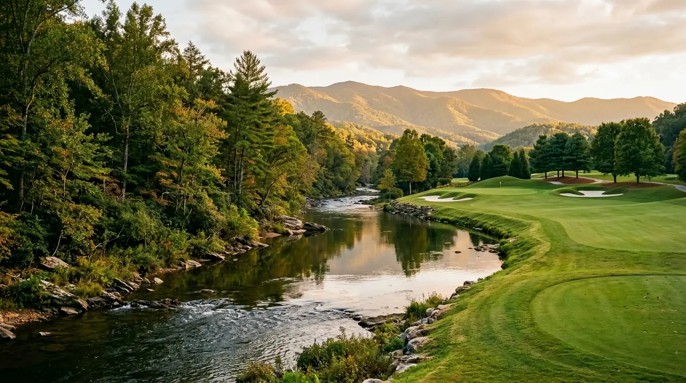
    A serene river flowing past a wild forest shoreline on one side and a manicured, sunny golf fairway on the other
    A serene river flowing past a wild forest shoreline on one side and a manicured, sunny golf fairway on the other

    Understanding the Chestatee River Corridor

    The Chestatee River winds through Lumpkin County before passing through Dawson County and eventually flowing into Lake Lanier. Near Dahlonega, the corridor refers to the privately held land along the river’s banks: a mix of rural residential lots, wooded homesites, and river-access parcels with no single master HOA. Buyers evaluating waterfront properties in Dahlonega purchase on the open market and deal directly with per-property considerations, including flood-zone designations, well and septic systems, and privately maintained driveways.

    Real estate along the corridor spans property types from older river cabins and seasonal retreats to newer construction on cleared homesites. Because it is not a single subdivision, exploring Chestatee real estate requires thorough per-property due diligence. You can find half-acre lots close to the road or multi-acre tracts with direct river frontage. Log-construction homes appear frequently; if you are considering one, plan for periodic refinishing, sealing, and restaining every three to five years depending on size and wood condition. Site-built framed homes and modulars are also common across the corridor.

    Quick answer: Corridor vs. Achasta

    Corridor properties offer open-land freedom, varied lot sizes, and no mandatory HOA fees, whereas Achasta provides gated access, maintained infrastructure, and a Jack Nicklaus Signature golf course.

    Due Diligence Caution

    Portions of the Chestatee River corridor fall within FEMA Special Flood Hazard Areas. Always review local flood risk profiles and consult flood zone guidelines for Lumpkin County waterfront property before making an offer.

    Exploring Life in Achasta

    Achasta is a private gated community on the Chestatee River situated just outside Dahlonega. Homes sit under a homeowners association that handles common-area maintenance, gate operations, and shared amenities. The community features multiple home sections, ranging from single-family custom builds to neighborhood cottages. Anyone interested in living in Achasta on the Chestatee River will find a structured environment with controlled access.

    The community is anchored by a Jack Nicklaus Signature 18-hole golf course that runs directly alongside the river. No comparable private golf community exists at this location in Lumpkin County. HOA obligations and membership options vary by section and tier, so buyers should confirm current fee schedules directly with the association or a local agent. For additional context on area neighborhoods, review our guide to riverside communities near Dahlonega GA .

    HOA & Membership Verification

    HOA dues and golf club membership tiers vary across Achasta’s sub-sections. Always obtain current fee schedules and association documents prior to submitting a purchase contract.

    Side-by-Side Setting Comparison

    Choosing between these two locations depends on your lifestyle preferences and how much community structure you desire. Many buyers who choose living along the Chestatee River value open land and flexibility, while others prioritize gated amenities.

    Factor Chestatee River Corridor Achasta
    Access Open market, no gate Private gated entry
    HOA None or minimal (varies by parcel) Required HOA with fees
    Golf No on-site golf course Jack Nicklaus Signature 18-hole course
    River Access Varies by parcel; direct on riverfront lots Course and community grounds front the river
    Price Character Varies by frontage, acreage, and structure Varies by section, lot location, and build style
    Lot Character Rural, wooded, larger lots common Established community, landscaped lots
    Infrastructure Well and septic common; verify per property Community infrastructure (confirm HOA docs)
    The right setting comes down to whether you prioritize unconstrained rural land ownership or managed community amenities with on-site golf.

    Frequently Asked Questions

    What is the Chestatee River corridor near Dahlonega?

    The Chestatee River corridor near Dahlonega is the privately held land along both banks of the river in Lumpkin County. It includes rural residential parcels, river-access lots, and wooded homesites without a single governing HOA. Properties vary widely by frontage, lot size, and construction type.

    Is Achasta on the Chestatee River?

    Yes. Achasta is a private gated community on the Chestatee River outside Dahlonega. The Jack Nicklaus Signature 18-hole golf course runs along the river, and many community lots back up to the course.

    Does Achasta have a golf course?

    Achasta has a Jack Nicklaus Signature 18-hole golf course. The course is the community’s central amenity and what separates it from other residential options in the Dahlonega area. Golf membership options and current fee structures are set by the club; confirm current tiers with Achasta directly.

    Can you buy riverfront homes outside of Achasta near Dahlonega?

    Yes. The open Chestatee River corridor has riverfront parcels and river-access homes with no gated-community affiliation. Availability shifts with market conditions; riverfront lots move faster than inland parcels. An MLS search filtered by river frontage in Lumpkin County is the most direct way to see current inventory.

    How do prices compare between Achasta and the Chestatee River corridor?

    Both settings span a range of valuations. Open-corridor homes vary based on inland position versus direct river frontage, while Achasta home values depend on the specific community section, lot views, and custom build details. Verify current market conditions with local MLS listings before drawing conclusions.

    Is Achasta a gated community?

    Yes. Achasta is a private gated community. Residents and guests enter through controlled access points. That matters to buyers who prioritize managed-access living or security.

    What are the HOA fees at Achasta?

    HOA fees in Achasta vary by community section and whether a social or golf membership is included. Combined monthly obligations depend on the tier and section. Request the current fee schedule from the Achasta HOA before making an offer, as fees and assessments can change.

    Does the Chestatee River corridor have an HOA?

    Most open-corridor properties along the Chestatee River near Dahlonega have no mandatory HOA. Some subdivisions along the corridor have deed restrictions or minimal road-maintenance agreements; check the specific parcel during due diligence. Buyers who want to avoid mandatory monthly fees often start here for that reason.

    Is Achasta a good place to retire?

    Achasta draws many retirees because of the golf course, the managed community, and proximity to Dahlonega’s services and dining. If golf or a community social calendar is part of your retirement picture, Achasta fits well. Buyers who want more land and fewer HOA restrictions tend to look at the open corridor instead.

    What should buyers know about flood zones along the Chestatee River?

    Portions of the Chestatee River corridor near Dahlonega fall within FEMA Special Flood Hazard Areas, which require flood insurance on mortgaged properties. Zone designations vary parcel by parcel. Check any property you are considering using the FEMA Flood Map Service Center at msc.fema.gov before writing an offer. Parcels with low elevation close to the water are most likely to carry a flood zone designation.

    Which is closer to downtown Dahlonega, the corridor or Achasta?

    Both are within a short drive of the Dahlonega town square. Achasta’s entrance is a few miles from the square; open-corridor properties range more widely in distance depending on their position along the river. Confirm drive times on a per-property basis.

    Can you fish or swim along the Chestatee River corridor?

    Access depends on the parcel. If you own riverfront property, you generally have access to the riverbank adjacent to your land. The Chestatee River is a trout stream in certain stretches; Georgia DNR fishing regulations apply. Swimming from private riverside parcels is at the owner’s discretion.

    How do I start looking for homes in either setting?

    Start with an MLS search filtered to Lumpkin County, then add river frontage or community name as criteria. A local agent with experience in both open-corridor parcels and Achasta resales can walk you through the specific due-diligence steps for each.

    Ready to compare your options on the ground?

    Explore current Dahlonega and Lumpkin County properties with our local expertise.

    Search North Georgia homes with Gold Peach Realty

    or call (770) 283-1223